Suitability maps are crucial in the agriculture, aquatic, and natural resources (AANR) sector to guide farmers and fisherfolk in identifying areas that will utilize and maximize resources and provide more yield.
Through the research and development (R&D) efforts of the Philippine Coconut Authority (PCA), coconut suitability maps generated in 2001 have now been enhanced and improved to incorporate more detailed environmental and socio-economic factors and expanded to cover areas from the provincial to the barangay level. In addition, existing assessment protocols have also been optimized by PCA through a 6-month project funded by the Philippine Council for Agriculture, Aquatic and Natural Resources Research and Development of the Department of Science and Technology (DOST-PCAARRD).
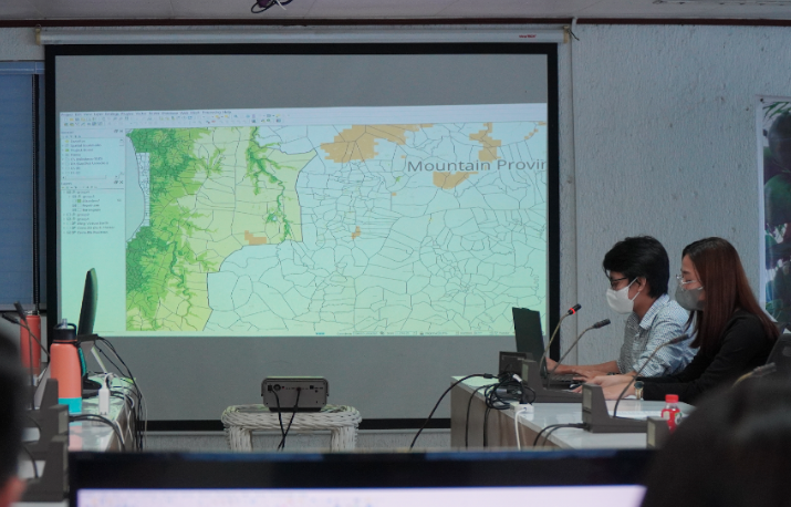
Titled, “Enhancement of the Field Assessment Protocols and Suitability Maps for Coconut,” the project aims to obtain data needed to create and enhance targeted and detailed area-specific suitability maps using a geographic information system (GIS), which collects and displays data associated with a specific location.
Led by PCA Deputy Administrator Ramon L. Rivera, the team, composed of experts from the PCA Davao Research Center (PCA-DRC) and the University of the Philippines Los Baños (UPLB), coordinates with the National Mapping and Resource Information Authority (NAMRIA), Bureau of Soils and Water Management (BSWM), Philippine Atmospheric, Geophysical, and Astronomical Services Administration (PAGASA), and the Philippine Statistics Authority (PSA).
In addition to creating suitability maps, the team was able to improve existing coconut suitability assessment protocols. The optimized forms now include remote and onsite assessments. The remote assessment indicates parameters on climatic, topographic, and socio-economic factors, while the onsite assessment covers coconut hybridization field assessment, participant's interest/consent, participant's good standing status, and the exclusion criteria assessment.
Former DOST-PCAARRD’s Agricultural Resources Management Research Division (ARMRD) Director Rodolfo O. Ilao served as the science and technology (S&T) consultant for the review. He commended the team for using the outputs from relevant government agencies as well as building partnerships with them. He recommended indicating the advantages of the enhanced protocol and crop suitability maps over the other systems developed locally or even abroad.
Once completed, the suitability maps will help ongoing hybridization efforts in identifying various areas of the country where coconut hybrids can be planted. This would lead to better resource prioritization and allocation as well as more data-driven policy formulation and decision-making by various coconut stakeholders.
DOST-PCAARRD’s Crops Research Division led by its newly-appointed Director Leilani D. Pelegrina recently conducted the review to evaluate the progress of the said project and recommend future actions for the sustainability of its outputs.