
Empowering higher education institutions (HEIs) near vulnerable coastal communities may help in preventing and managing coastal erosion. This was the goal of the Coastal Erosion Management Training (CEMTiMe) developed through a project funded by the Philippine Council for Agriculture, Aquatic and Natural Resources Research and Development of the Department of Science and Technology (DOST-PCAARRD).
The project, “Communication, Education and Public Awareness (CEPA), and Policy Review Towards Improving Coastal Erosion Management in the Philippines” was able to develop training materials to be used in engaging educators and multiply efforts in mapping and identifying areas that are currently eroding in the Philippines. Moreover, it hopes to inform future coastal planning, development, and management.
Under the CEPA Project, two trainings on coastal erosion management for tertiary teachers were conducted in Ilocos Norte in 2017 and Albay in 2018, and another training was organized by the Marine Resources Research Division (MRRD) of DOST-PCAARRD in 2019. These CEPA materials benefitted greatly from observations, data, and learnings gathered from previous coastal erosion projects funded by DOST-PCAARRD, namely the ReSILiENT SEAS (Remote Sensing Information for Living Environment and Nationwide Tools for Sentinel Ecosystems in our Archipelagic Seas) Program and the Acquisition of Detailed Bathymetry for Coastal Erosion Management (Bathy and Erode).
Aside from the CEPA mate rials, learnings and local examples accumulated through the years of doing coastal erosion work in the Philippines are also embodied in the Guidebook on Coastal Erosion Management, which was written and published under the Bathy and Erode, and CEPA projects, respectively.
This year, the CEMTiMe was adopted by DOST-Philippine Council for Industry, Energy and Emerging Technology Research and Development (DOST-PCIEERD) through the NICER-CoastER program (Niche Centers in the Regions for Research and Development-Coastal Engineering and Management Research and Development Center) Project 1: Coastal Erosion Trends and Management Strategies for Region 1. The training was conducted on July 4-8, 2022 at the International Convention Center of Don Mariano Marcos Memorial State University-North La Union Campus (DMMMSU-NLC).
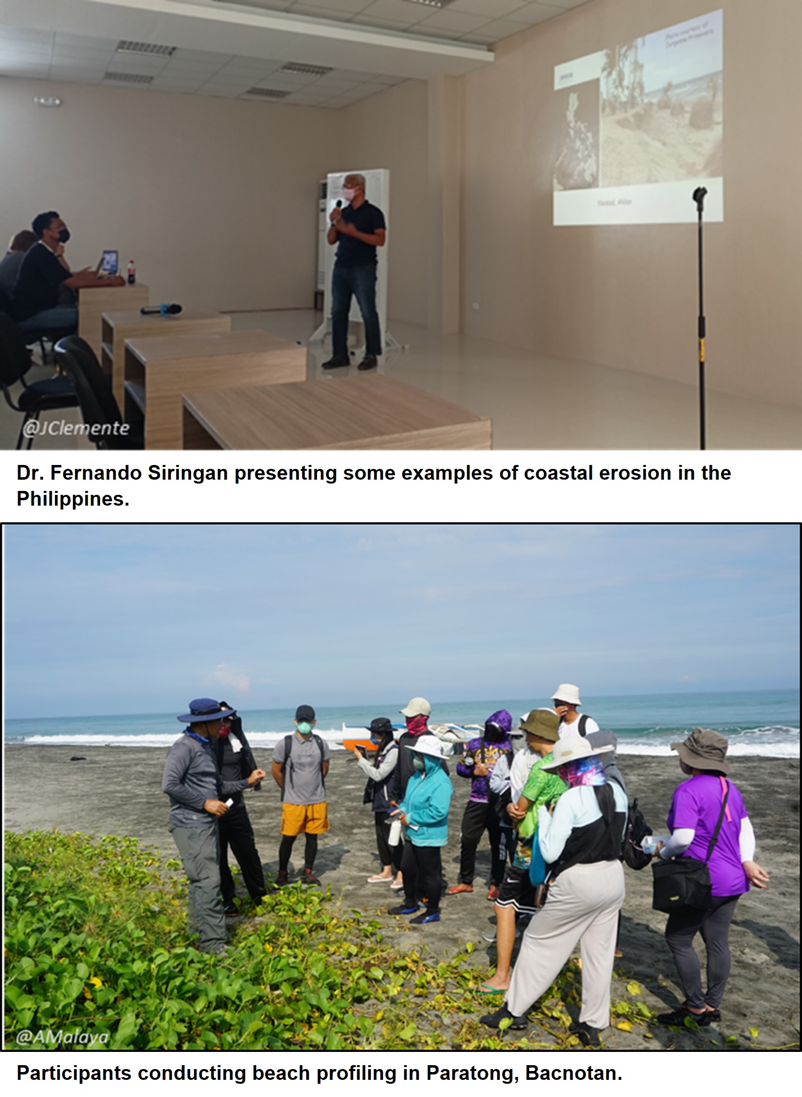
The five-day training program is composed of lectures on coastal erosion, coastal processes, coastal hazards and field visit on three sites: Paratong in Bacnotan, Paraoir in Balaon, and in Luna, La Union.
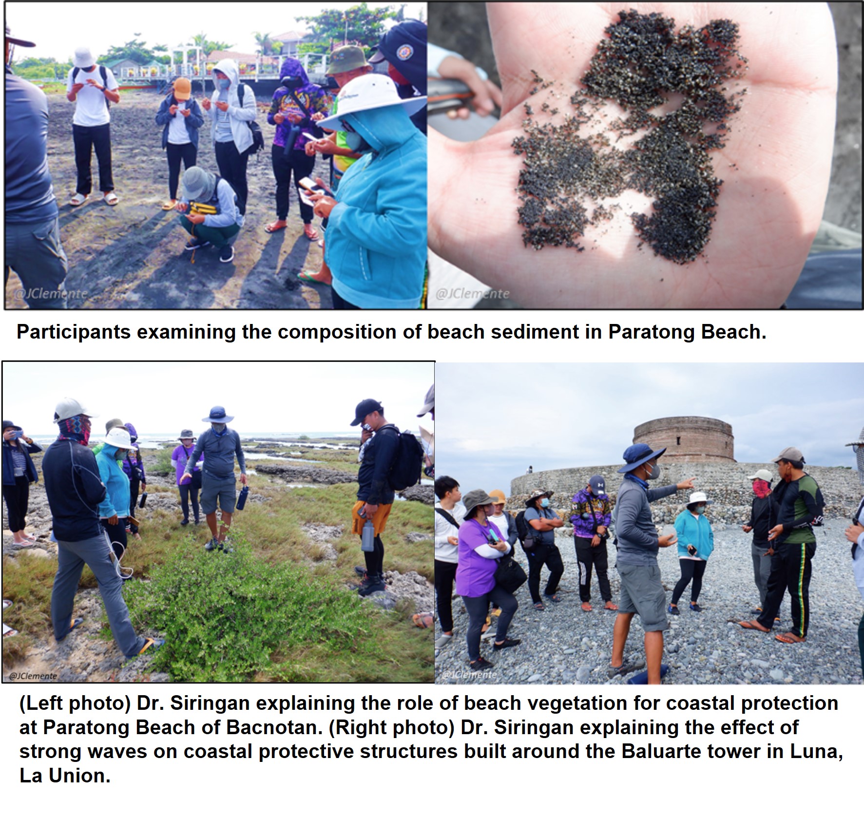
Three sites were visited which showed the different coastal environments and processes that were discussed: (1) the beach in Paratong,Bacnotan whose sediments are land-derived, (2) coral reef-fringed coast of Paraoir in Balaoan, and (3) the gravel beach of Luna in Paratong, Bacnotan. The participants learned the beach profiling method for beach monitoring and field techniques and the role of bea ch vegetation for coastal protection. The highlight of the activity was the role of coral reefs in providing sediments and protection of the beach in Paraoir.
In Luna, changes in the vicinity of the Baluarte Watchtower, impacts of gravel extraction, and the possible effect of waves on the protective structures surrounding the watchtower were discussed. Other topics included coastal processes, coastal landforms, coastal hazards with a focus on Geographic Information System (GIS) methods that are used to quantify the shoreline changes of an area through maps and satellite imagery, and management of coastal erosion using engineering structures such as groins and seawalls. Alternative ways were also shared to prevent coastal erosion such as the planting of mangroves, native coastal trees, and other vegetation.
 Sediment samples from beaches around the Philippines were passed around for the participants to compare. (Right photo) Engr. Julius Butay from MMSU presenting their findings on shoreline change at the mouth of Laoag River in Ilocos Norte.")
At the end of the session, the participants were able to use georeference topographic maps that NAMRIA (National Mapping and Resource Information Authority) produced; check the alignment of maps and satellite images, extract shoreline trace from maps and Landsat satellite imagery; and compare the changes in shoreline positions.
The five-day training equipped the participants with essential knowledge on coastal processes that drive coastal erosion. The different coastal processes, drivers of coastal risk, future impacts due to climate change and the use of different management approaches to mitigate coastal risk were discussed during the training. This knowledge together with the methods learned will aid the HEIs in making recommendations for improving future coastal planning, development, and management